
-
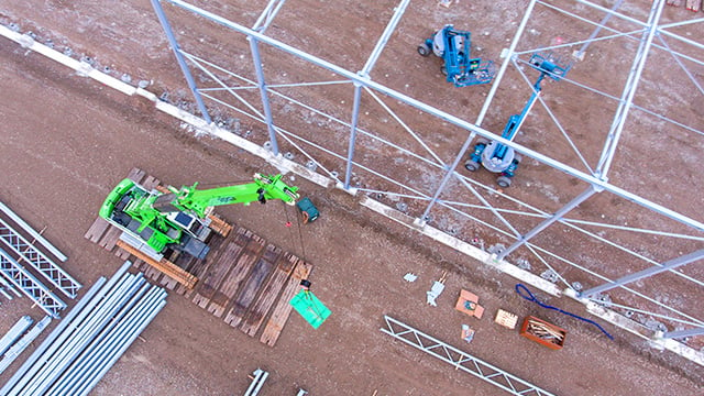
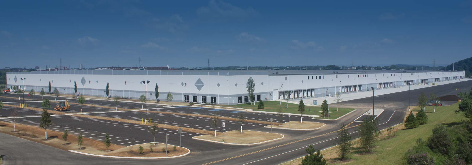 Industrial Storage, Warehouses & Data Centers
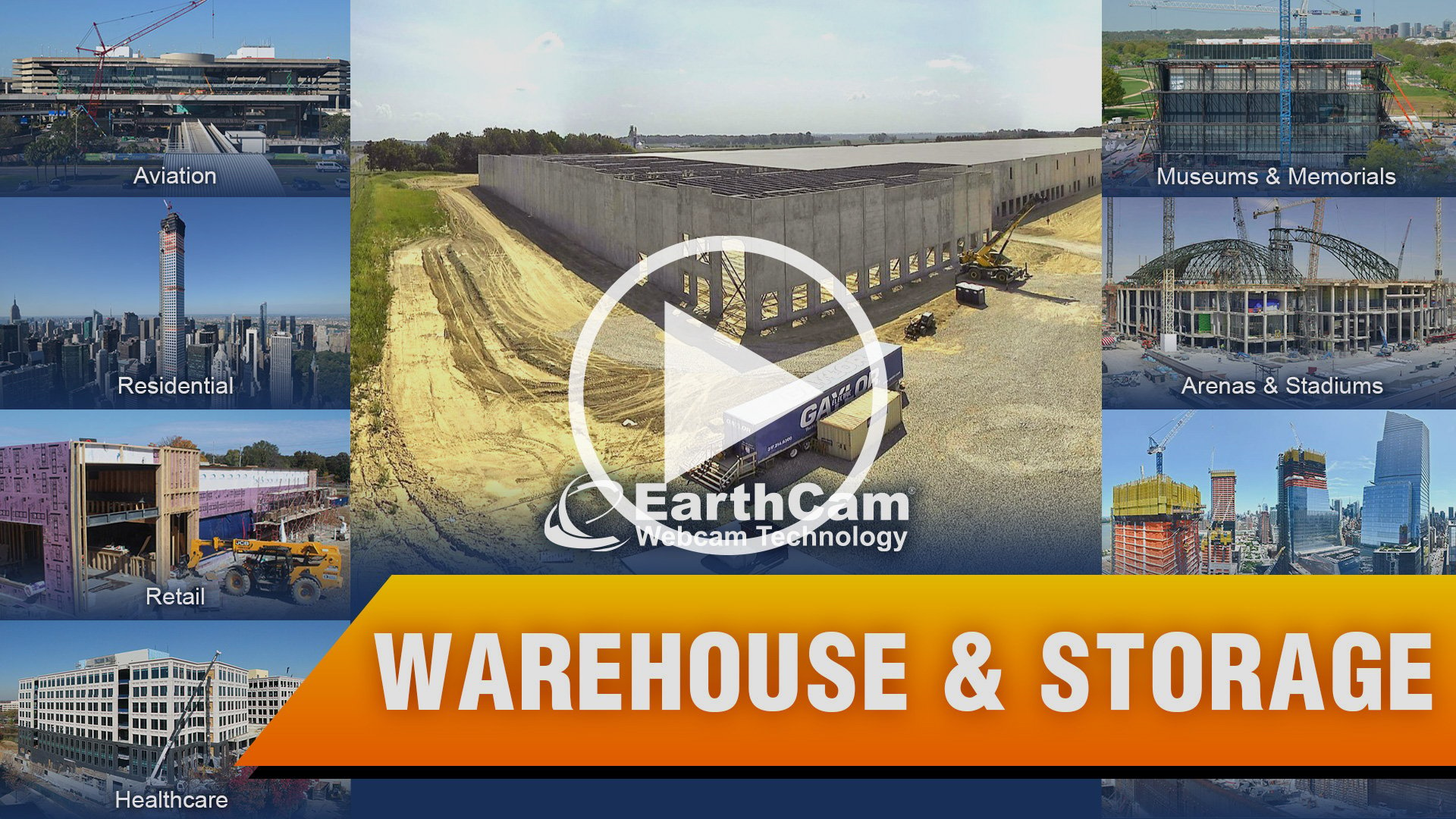
Monitor Jobsite Productivity, Safety & Security
Use live-streaming technology to remotely check in on your jobsite
Time-Lapse

Live Streaming & Monitoring


360° Cameras & Specialty Options


Time-Lapse
Live Streaming & Monitoring
360° Cameras & Specialty Options
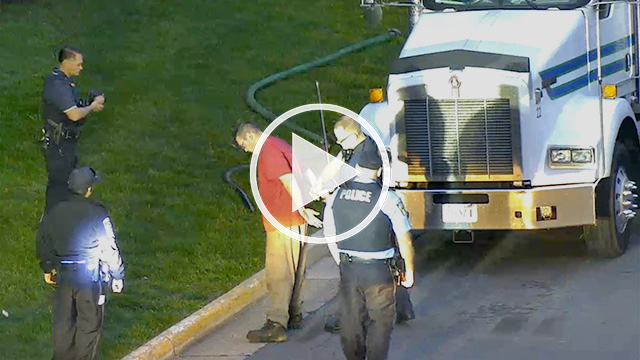
Facility Management & Advanced Security Services
Use EarthCam to view, verify and respond, utilizing AI object recognition, thermal and AI cameras. Perimeter intrusion detection sends alerts to EarthCam’s Central Station Monitoring (CSM) where trained professionals assess the risk and dispatch law enforcement when necessary. Protect parking lots, facilities and public areas with AI Object Detection.
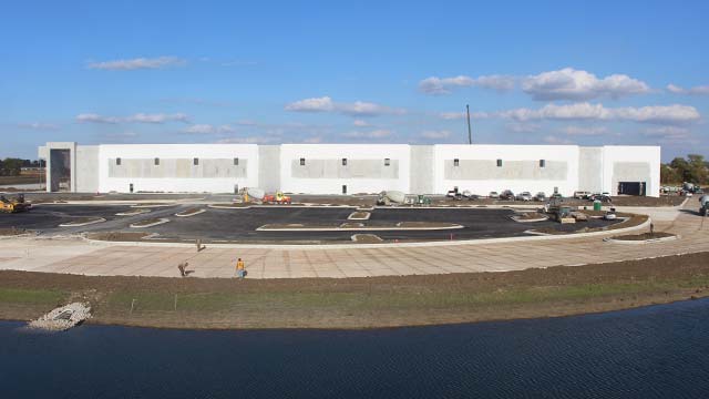
Construction Documentation
View your jobsite remotely in real-time to make informed decisions quickly. Document progress with high-quality imagery and live streaming video. Visual content is automatically analyzed and high-impact construction time-lapse can be shared with stakeholders.
Edited Time-Lapse Movies
Promote your projects with automatically-generated time-lapse videos using Control Center 9 or consult with our award-winning producers who will customize a cinematic finished product. Promote your projects to the public to generate excitement and share your dynamic video online.

AI for Safety, Security & Productivity
AI Media Dashboard is a rich visualization tool that generates automated in-app alerts for AI-detected events and observations, such as and PPE advisories or when workers are at height or in close proximity to energized equipment. Share real-time status of personnel, equipment and materials and easily find video of specific events using Boolean search.
Better Lives Through Visual Information®
EarthCam Air – UAV & 3D Geospatial Imaging Service
Maximize the benefits of your project documentation process by combining all-weather cameras and 3D imaging with EarthCam's UAV and aerial imagery services. EarthCam Air also provides cloud-based storage solutions and distribution tools for sharing the unique content derived during UAV flights over your jobsite.
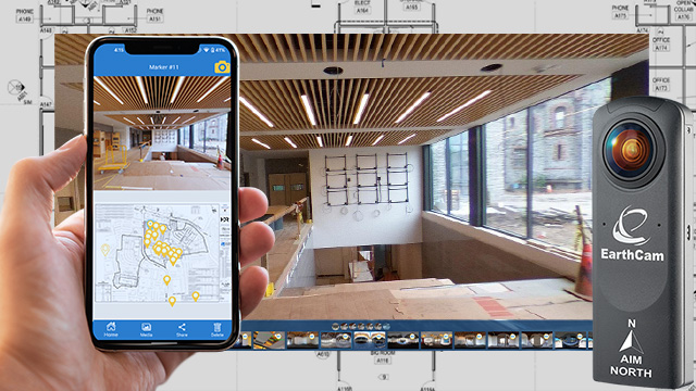
VR Site Tour – On-site 360 VR Photograph
EarthCam's VR Site Tour App is specifically designed for quick, straightforward DIY reality capture for small-to-medium jobsites. Capture and communicate interior progress with interactive 360° images automatically assembled into a virtual project tour. Evidence actual live progress, reduce the need for site visits, and prevent rework.
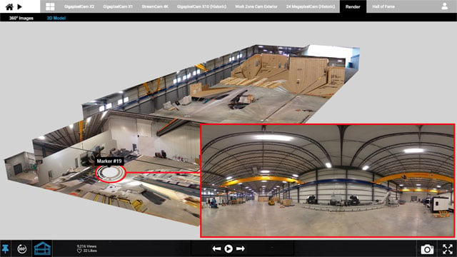
VR Dollhouse View
VR Dollhouse views are created by merging 360° photo content with Navisworks or Revit models for a new way to walk the jobsite. Previously, generating these views required time consuming and expensive scans. Quickly assess jobsite progress, resolve disputes and communicate with stakeholders using remote fly-through navigation and gamified controls. Increase the value of your 360° photography, by accurately incorporating it with 3D models.
Walk-through with VR DollhouseSoftware - Control Center 9
Control multiple construction camera networks with EarthCam’s software, using breakthrough AI technology for safety, security and productivity. Empower users with high quality imagery, on-site data and collaboration tools all in one visual Information ecosystem for construction.
- Live stream secured & encrypted
- Flexible archiving options
- Instant Presentation-Ready Time-Lapse
- Weather data - current & historical
- Take instant snapshots anytime
- Email, save & share content
- Easily embed in any website
- Satellite map & site plan integration
- Image mark-up & comparison tools
- Automated progress reports
- Continuous support & training
